Category:Ladywell Fields
Jump to navigation
Jump to search
park in London Borough of Lewisham, United Kingdom  | |||||
| Upload media | |||||
| Instance of | |||||
|---|---|---|---|---|---|
| Location | London Borough of Lewisham, Greater London, London, England | ||||
 | |||||
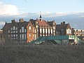
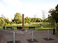
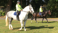
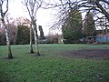
Ladywell Fields, originally Ladywell Recreation Ground is a public park in the London Borough of Lewisham created from three historic fields. It is located near Ladywell railway station at the northern end of the park, and Catford Bridge at the southern end.
Media in category "Ladywell Fields"
The following 64 files are in this category, out of 64 total.
-
 A parched Ladywell Fields.jpg 4,032 × 3,024; 4.85 MB
-
 Blossom, Ladywell Fields - geograph.org.uk - 2398413.jpg 640 × 449; 92 KB
-

-

-
 Bridge under the railway, Ladywell Fields - geograph.org.uk - 841180.jpg 640 × 480; 101 KB
-
 Church beyond Ladywell Fields - geograph.org.uk - 3171865.jpg 640 × 430; 79 KB
-
 Dry Stream Garden and sculptures - geograph.org.uk - 2618771.jpg 4,288 × 3,216; 5.96 MB
-
 Dry Stream Garden, Ladywell Fields - geograph.org.uk - 2618785.jpg 4,288 × 3,216; 6.75 MB
-

-
 Footbridge in Ladywell Fields - geograph.org.uk - 5470025.jpg 640 × 424; 90 KB
-
 Holbeach Primary School - geograph.org.uk - 1633717.jpg 640 × 480; 47 KB
-
 Ladywell Fields (2) - geograph.org.uk - 2252099.jpg 640 × 480; 168 KB
-
 Ladywell Fields (3) - geograph.org.uk - 2252192.jpg 640 × 480; 165 KB
-
 Ladywell Fields (4) - geograph.org.uk - 2252321.jpg 640 × 480; 123 KB
-
 Ladywell Fields (5) - geograph.org.uk - 2252357.jpg 640 × 480; 100 KB
-
 Ladywell Fields - geograph.org.uk - 2020963.jpg 2,048 × 1,536; 1.19 MB
-
 Ladywell Fields - geograph.org.uk - 2252098.jpg 640 × 480; 163 KB
-
 Ladywell Fields - geograph.org.uk - 227032.jpg 640 × 480; 132 KB
-
 Ladywell Fields - geograph.org.uk - 3165008.jpg 640 × 430; 111 KB
-
 Ladywell Fields - geograph.org.uk - 3168373.jpg 640 × 430; 59 KB
-
 Ladywell Fields - geograph.org.uk - 3168381.jpg 640 × 430; 68 KB
-
 Ladywell Fields - geograph.org.uk - 3168401.jpg 640 × 430; 119 KB
-
 Ladywell Fields - geograph.org.uk - 3168408.jpg 640 × 430; 72 KB
-
 Ladywell Fields - geograph.org.uk - 3168413.jpg 640 × 430; 87 KB
-
 Ladywell Fields - geograph.org.uk - 3171721.jpg 640 × 430; 65 KB
-
 Ladywell Fields - geograph.org.uk - 3171729.jpg 640 × 430; 81 KB
-
 Ladywell Fields - geograph.org.uk - 3171851.jpg 640 × 430; 94 KB
-
 Ladywell Fields - geograph.org.uk - 437047.jpg 640 × 480; 140 KB
-
 Ladywell Fields - panoramio.jpg 2,048 × 1,356; 927 KB
-
 Ladywell Fields after development - geograph.org.uk - 691859.jpg 640 × 365; 34 KB
-

-
 Ladywell Fields, hand pump detail - geograph.org.uk - 2523526.jpg 640 × 480; 170 KB
-
 Ladywell Fields, hand pumps - geograph.org.uk - 2523518.jpg 1,024 × 768; 392 KB
-
 Ladywell Fields, London Borough of Lewisham, SE13 SE6 (2611258266).jpg 2,560 × 1,920; 887 KB
-
 Ladywell Fields, new footbridge - geograph.org.uk - 2523497.jpg 1,024 × 768; 254 KB
-
 Ladywell Fields, new planting - geograph.org.uk - 2523544.jpg 1,024 × 768; 357 KB
-
 Ladywell Fields, observation steps - geograph.org.uk - 2523534.jpg 1,024 × 768; 507 KB
-
 Ladywell Fields, observation steps - geograph.org.uk - 2523538.jpg 480 × 640; 205 KB
-
 Ladywell Fields, renewed bridge - geograph.org.uk - 2523556.jpg 1,024 × 768; 495 KB
-
 Ladywell Fields, Sept 2016 IMG 3404.png 1,136 × 640; 1.71 MB
-
 Ladywell Fields, west of the river - geograph.org.uk - 2523530.jpg 1,024 × 768; 357 KB
-
 Landscape feature in Ladywell Fields - geograph.org.uk - 2502074.jpg 4,000 × 3,000; 4.01 MB
-
 Lewisham Dutch Elm.jpg 3,024 × 4,032; 5.23 MB
-
 Lewisham Elm.jpg 2,448 × 3,264; 3.13 MB
-
 Lewisham Hospital - the new block - geograph.org.uk - 1633694.jpg 640 × 480; 48 KB
-
 Lewisham, across Ladywell Fields - geograph.org.uk - 1331461.jpg 640 × 480; 85 KB
-

-
 Lewisham, Ladywell Fields - geograph.org.uk - 1331455.jpg 640 × 480; 85 KB
-

-

-
 Open space with shelter, Ladywell Fields - geograph.org.uk - 1633754.jpg 640 × 480; 127 KB
-
 Path junction in Ladywell Fields - geograph.org.uk - 2618846.jpg 4,288 × 3,216; 7.15 MB
-
 Play facility in Ladywell Fields - geograph.org.uk - 1633692.jpg 640 × 480; 70 KB
-
 Pond in Ladywell Fields - geograph.org.uk - 2501934.jpg 4,000 × 3,000; 4.01 MB
-
 Pond, Ladywell Fields - geograph.org.uk - 3040758.jpg 640 × 480; 99 KB
-
 Railway alongside Ladywell Fields - geograph.org.uk - 231841.jpg 640 × 480; 109 KB
-
 Ravensbourne diversion channel in Ladywell Fields - geograph.org.uk - 2712275.jpg 3,456 × 2,592; 3.26 MB
-
 Ravensbourne diversion channel in Ladywell Fields ^2 - geograph.org.uk - 2712281.jpg 3,456 × 2,592; 3.08 MB
-
 Recreation Ground, Ladywell Fields - geograph.org.uk - 437051.jpg 640 × 480; 135 KB
-
 Spiral bridge in Ladywell Fields - geograph.org.uk - 841187.jpg 640 × 480; 163 KB
-
 St Mary's church from the south-west - geograph.org.uk - 841194.jpg 639 × 479; 89 KB
-
 UHLRiverside01.jpg 3,094 × 1,503; 1.15 MB
-
 View of Malyons Road from Ladywell Fields - geograph.org.uk - 2716091.jpg 3,456 × 2,592; 3.11 MB
-
 View of the play area in Ladywell Fields - geograph.org.uk - 2716112.jpg 3,456 × 2,592; 3.22 MB


_-_geograph.org.uk_-_2252099.jpg)
_-_geograph.org.uk_-_2252192.jpg)
_-_geograph.org.uk_-_2252321.jpg)
_-_geograph.org.uk_-_2252357.jpg)


.jpg)


